Untraveled Roads to most traveled roads. Jawadu hills to Yercaud hills
2 Biker & 1 Bull - RE Classic 350 - The real hero of the trip
Starting Odometer reading - 13215.4 kms / Ending Reading 13775.8 kms ~ 560 kms
Petrol ~ approx 18 lts
Day 1
Chennai-Tambaram-Vellore on NH5
Started 9.30 pm - Reached 1.00 pm
Highway Night riding
Stay at Friends house
Day 2
Vellore - Chenganatam-Balamathi - Amirthi-Nimiambattu ( Jawadu hills ) - Off road trail between Sermarathur - Jamuna Marathur - took Polur-Vaniambadi Road reached Jamaunamarathur
Started 11.30 am - Reached 6.00 pm
Riding through chenganatam forest trail - visited Balamathi Murugam temple.
Riding through Ghat Roads, off roads
Stayed at Govt. BDO Lodge Jamunamarthur. Other Logding available are Forest Guest house, Missionary hostel
Day 3
Jamaunamarathur - Attipet on Polur Vaniambadi road - Melpet - Chengam through Ghat Road - Singarapetti - Hanumathathirtam - Harur - Kuppanoor - Yercaud Ghat road - Yercaud
Started 11.30 am - Reached 7.00 pm
We had a refreshing bath at Bheeman falls. Riding through Ghat roads until Chengam . Riding in SH and country roads until Kuppanoor. Kuppanoor to Yercaud via Ghat road
Stay in a budget lodge at Yercaud near Gandhi park.
Day 4
Yercaud - Salem - kolampatti rountana Seenu Transport - Salem New Bustand - Vellore - Chennai CMBT - back home
Started 5.30 pm - Reach 5.00 am next day
On bike
Visited Montford Church - Ladies seat - Gents seat - Children seat View points - Rose Garden -
Pogoda Point view point -
Kiliur waterfalls, On bike and Walk down 250 steps down hill and up hill
On bike
Shervaroyan Temple - Sri Maha Meru Rajarajeshwari Temple - Yercaud - Yercaud Ghat Road - Salem - Salem Bypass to pack up Bike in lorry parcel servcice
On Bus
Salem bypass - Salem New Busstand - Vellore - Chennai CMBT - back home
--------------------------------------
I am trying to route maps of our trip but some of the roads are not marked in Google maps
I have posted the nearest I can get
Day 1
Day 2
Part 1 is on Wikimapia as Forest trail between Chenganatam to Balamathi not mark in Google map.
Part 1 is on Wikimapia as Forest trail between Chenganatam to Balamathi not mark in Google map.
Stream Crossing between Naganathi and Amirthi Not marked on google map. No road marked beyond Amirthi
 |
| Vellore to Chengam on Wikimapia Day2 Part 2 on Google Map |
Day 4
Yercaud - Salem - Vellore - Chennai
Enjoy the Snaps !!
Day 2


Starting of Day 3 Jawadu hill to Yercaud


 |
| On the way to Amirthi.. |
 |
| Crossing a Stream |
 |
| May be it is the Naganathi |
 |
| Road Towards Nimiambattu Jawadu Hills |
 |
| Jawadu Hill Road |
 |
| With the backdrop of other hills |
 |
| It was a cloudy day .. at 2.00 pm |
 |
| Stream with tree in the middle |
 |
| Starting the of , off road trail |
 |
| Stream 1 Crossing |


 |
| Can you spot the tail lamp of the bike at the head of the steep slope |
 |
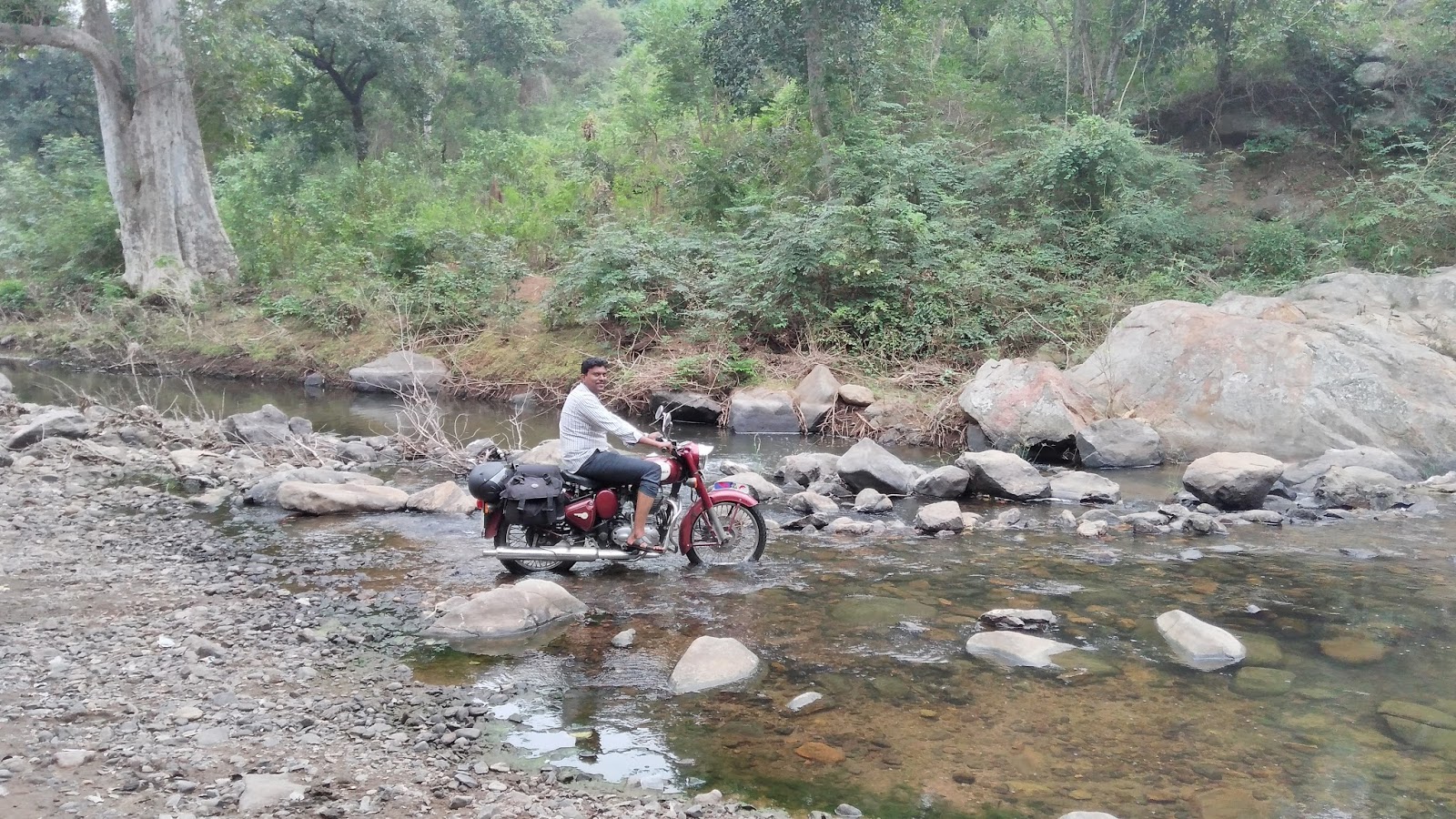
| At Rocky stream #2 . Crossing this was much more difficult |
Starting of Day 3 Jawadu hill to Yercaud
 |
| Attipet to Chengam Road - Neat |

 |
| At Secluded Melpet forest Bunglow |
 |
| Path to Forest Bunglow |
 |
| View of Valley down hill for Melpet to Chengam |
 |
| Distant view of Kuppanatham Dam |

 |
| Chengam Perumal Koil Temple tower |
 |
| Due to road block had to ride in dirt track - Between Singarapetti and Hanumanthatheeram |
 |
| View of Thenpennai River from Bridge at Hanumanthateeram |
 |
| Start of Yercaud Ghat Road at Kuppanoor |
 |
| View of Plains below for Yercaud Ghat Road,, Distant view of Kalvarayan Hills |
 |
| Message board at Yercaud lake |
 |
| Monteford School Campus Yercaud |
 |
| View of Children seat View point |
 |
| Misty morning at Yercaud |
 |
| At Rose Garden |
 |
| Path way at Rose Garden |
 |
| Posing in the path way |
 |
| Kiliyur waterfalls |
 |
| Enjoying the view of waterfalls |
 |
| Majestic view of Kiliur falls |
 |
| At Botanical Garden Yercard |
 |
| Orchid growing in off Season, a rare site |
 |
| Set against the skies. At the peak of Shervaroyan Hill |
 |
| At the peak looking down, Bauxite mine in back drop |
 |
| Road to Bauxite mines Shervaroyan hills After all this snippets , what is still missing are picture of Forest trail between Vellore and Balamathi on day 1. We were too immersed in the adventure, we forgot to take snaps. And snaps of rejuvenating bath at the Bheeman waterfall. I have to say it was bath of my life. We did not bother to carry Phone to take snaps as we do not know if it can be kept safe during our bathing. But when we were bathing the mother nature was only caring us, Not a soul around. I will surely recommend people to visit Bheeman falls between Nov-Jan . Meet you in next joureny :) Thanks for visiting !! |
Thanks for sharing your valuable article!!
ReplyDeletePlanning your first trip from Yerkad to Vellore? It may be overwhelming. Many struggle where to start the plan and which is the best mode of transport. The most probable question before you plan for the places to explore in the destination is how you are planning the trip. Is it by road or train? By road is your choice, then comes the question whether public transport or cab?